
Where to find us
Fjordane Folk High School is located in the middle of Nordfjordeid, which in turn is located in the middle of Stad municipality, north of Vestland county. Click on the pin in the map above to open in Google Maps.
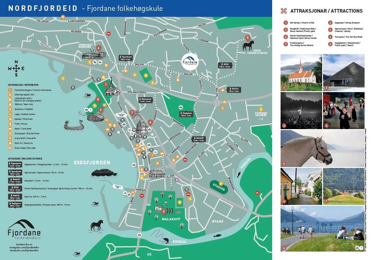
Click on the image to open a map of Nordfjordeid in pdf.
How to get here
You can get to Nordfjordeid by bus, car, boat and plane.
Bus
The easiest way is to take the bus. There are direct routes from both Oslo and Bergen, and it is possible to travel from Trondheim via Ålesund. The bus journey from Oslo takes 9.5 hours and from Bergen about 6 hours. From Trondheim, via Ålesund, you must calculate a 9.5 hour journey.
Feel free to plan your trip with:
Fly
The nearest airports are Sandane Airport and Ørsta/Volda Airport, and Widerøe flies to and from. Sandane Airport is 40 minutes from the school, including a ferry ride. It is possible to book an air taxi. From Ørsta/Volda Airport it takes just over an hour by car. You can take a regular bus right at the airport.
It is also possible to fly to Ålesund Airport Vigra, but then the journey between the school and the airport will be quite long, about 3 hours by car. There is an airport bus from Vigra to Moa, and then a regular bus from Moa to Nordfjordeid.
Feel free to plan your trip with:
Boat
From Bergen you can also take the express boat to Måløy. There is a regular bus from Måløy to Nordfjordeid.
Feel free to plan your trip with:
Car
There are good roads in all directions, but remember that in western Norway there are often ferries, tunnels and mountain passes. If you drive a car, we always encourage you to carpool with other students. Socially and environmentally friendly!
Ferry
Western Norway has many fjord crossings. The ones closest to the school are:
Ferry Anda/Lote (if you are coming from Sandane/Sogn/Bergen)
Ferry Volda/Folkestad (If you are coming from Ålesund/Volda/Ørsta. NB! To avoid the ferry, you can also drive via Grodås)
Distances to/from Nordfjordeid
40 km to Volda
50 km to Stryn
60 km to Måløy
80 km to Hoddevik
100 kilometers to Førde
110 kilometers to Ålesund
300 kilometers to Bergen
400 kilometers to Trondheim
450 kilometers to Oslo

NB! The school road is a one-way street from west to east. Follow the blue line when driving to school.